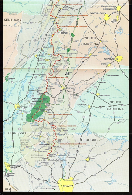
AT Map, GA, NC, TN
The Appalachian Trail Conference sells a unique map of the A.T. This strip map is about 9 inches wide by 48 inches high. This portion shows the Trail in Georgia, North Carolina and Tennessee (red dash line). Unlike the topographical USGS maps available, this gives a bigger picture of the southernmost section of the 2100+ route I'm about to walk.